
The renewed California Hunting Atlas now includes detailed public-land maps, updated 2026-2027 season information, and expanded field-use value for California hunters. The Hunterizer app also now supports instant location-based huntability checks and waypoints.
SAN JOSE, Calif., July 2026 – Hunterizer, a geospatial hunting intelligence platform, today announced the release of the California 2026-2027 Hunting Atlas – a comprehensive guide to hunting in CA, continuing its third consecutive year of producing practical, map-based hunting content for California hunters.
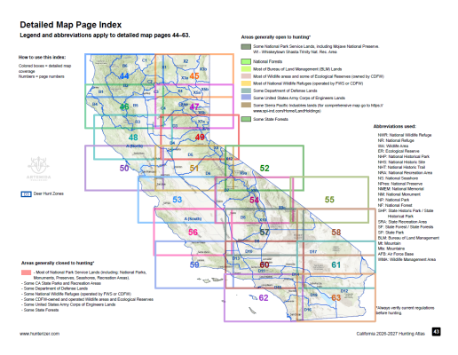
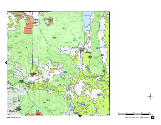
The renewed atlas includes updated California hunting season information, regulations, zone maps, and 20 detailed maps of California public lands. Built for hunters who need clear, field-ready information, the atlas helps users understand where hunting opportunities exist, how zones are structured, and how public lands relate to hunting access across the state.
The CA Hunting Atlas also includes kill spot maps for major species: deer, bear, wild pig, and other California big game. Created using official kill spot data from CDFW, these maps are unique — they are published only in the CA Hunting Atlas and are highly sought after by hunters.
The California Hunting Atlas is available in both print and digital formats:
Print edition:
https://hunterizer.com/product/ca-hunting-atlas-print/
Digital edition:
https://hunterizer.com/product/ca-hunting-atlas-digital/
“California hunting rules are complex, and hunters often need to combine regulations, season dates, zone boundaries, and public-land information from many different sources,” said Vlad Powerman, co-founder of Hunterizer. “Our goal with the California Hunting Atlas is to make that information easier to use in the field and during trip planning.”
In addition to California, Hunterizer also publishes hunting atlases for Pennsylvania and Texas. New releases for both states are expected soon, bringing updated season information, maps, and field-use content to hunters in those states.
Hunterizer also announced a significant upgrade to the map inside the Hunterizer mobile app. Users can now tap directly on the map and instantly see what is huntable at that specific location, based on the selected date and available regulatory data. The app now also supports waypoints, allowing hunters to mark and organize important locations while scouting, planning, or navigating.
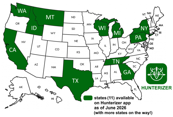
Map of 11 states covered by the Hunterizer app
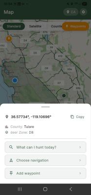
The improved map experience is designed to reduce the friction of answering a basic but critical hunting question: “What can I legally hunt here, right now?”
The Hunterizer app combines hunting seasons, species, zones, regulations, and location intelligence into a single map-based interface. With the new click-on-map functionality, hunters no longer need to manually cross-reference multiple maps and tables to understand local hunting opportunities. They can simply select a point on the map and receive location-specific information.
About Hunterizer
Hunterizer is a geospatial hunting intelligence platform that helps hunters understand what is legal to hunt at a given place and time. Hunterizer provides digital hunting atlases, interactive maps, and mobile tools that combine season dates, hunting zones, regulations, public-land information, and species-specific rules into practical field-ready products.